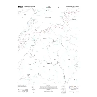
2013 Map of Grandfather Mountain
USGS Topo · Published 2013About this map
Grandfather Mountain Calloway Peak dominates this topographic landscape, serving as the dramatic centerpiece for a region defined by high-elevation ridges and deep stream prongs. The map documents a sophisticated network of mountain infrastructure, from the iconic Mile High Swinging Bridge and Linville Bluffs to the winding Blue Ridge Pkwy. To the west, the settlement of Linville sits near the headwaters of the Linville River, while the eastern slopes descend toward smaller communities like Gragg and Roseborough. The terrain is marked by distinctive formations such as The Sphinx Rock and Rattlesnake Cliffs, illustrating the complex geology of the Pisgah National Forest area. These details capture the intersection of early 21st-century tourism and the enduring rural character of the North Carolina high country.
Find a feature on this map
132 named features on this map. Tap any name to fly to it.
Don’t see what you’re looking for? This feature index may not catch every label — zoom into the map to look around manually.
Map Details
Editions of this 2013 Grandfather Mountain Map
This is the sole edition of this map. No revisions or reprints were ever made.
Other maps of this area

1893 · Cranberry
USGS Topo · 1:125,000

1895 · Cranberry
USGS Topo · 1:125,000

1899 · Cranberry
USGS Topo · 1:125,000

1902 · Cranberry
USGS Topo · 1:125,000

1905 · Morganton
USGS Topo · 1:125,000

1934 · Valle Crucis
USGS Topo · 1:24,000

1934 · Elk Park
USGS Topo · 1:24,000

1934 · Linville Falls
USGS Topo · 1:24,000

1934 · Boone
USGS Topo · 1:24,000

1934 · Newland
USGS Topo · 1:24,000