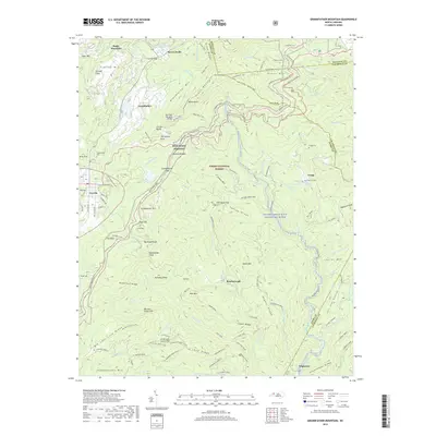
2019 Map of Grandfather Mountain
USGS Topo · Published 2019About this map
Grandfather Mtn and the surrounding high-country landscape of the Pisgah National Forest are captured here at the intersection of Watauga, Caldwell, and Avery counties. The topography is defined by prominent peaks and cliffs, including Sugar Mountain, Flattop Mtn, and Calloway Peak, alongside the iconic Mile High Swinging Bridge. The mapping illustrates a complex network of recreational trails such as the Profile Trail and Tanawha trail, which weave through the terrain alongside the Blue Ridge Pkwy.
Find a feature on this map
125 named features on this map. Tap any name to fly to it.
Don’t see what you’re looking for? This feature index may not catch every label — zoom into the map to look around manually.
Map Details
Editions of this 2019 Grandfather Mountain Map
This is the sole edition of this map. No revisions or reprints were ever made.
Other maps of this area

1893 · Cranberry
USGS Topo · 1:125,000

1895 · Cranberry
USGS Topo · 1:125,000

1899 · Cranberry
USGS Topo · 1:125,000

1902 · Cranberry
USGS Topo · 1:125,000

1905 · Morganton
USGS Topo · 1:125,000

1934 · Valle Crucis
USGS Topo · 1:24,000

1934 · Elk Park
USGS Topo · 1:24,000

1934 · Linville Falls
USGS Topo · 1:24,000

1934 · Boone
USGS Topo · 1:24,000

1934 · Newland
USGS Topo · 1:24,000