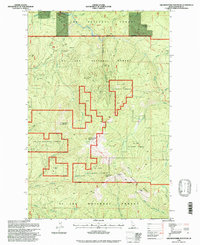
1995 Map of Grandmother Mountain
USGS Topo · Published 1997About this map
Timber heritage and rugged backcountry topography define this mid-1990s survey of the St Joe National Forest in Shoshone County. The map preserves the location of specialized logging machinery and infrastructure, most notably the Hobo Creek Splash Dam and Steam Donkey and the Cornwall Steam Donkey. These features, along with a noted Logging Camp, point to the intensive industrial history of the Marble Creek and Hobo Creek drainages.
Find a feature on this map
34 named features on this map. Tap any name to fly to it.
Don’t see what you’re looking for? This feature index may not catch every label — zoom into the map to look around manually.
Map Details
Editions of this 1995 Grandmother Mountain Map
This is the sole edition of this map. No revisions or reprints were ever made.
Other maps of this area

1914 · Avery
USGS Topo · 1:125,000

1917 · Avery
USGS Topo · 1:125,000

1923 · Washington Creek
USGS Topo · 1:125,000

1936 · Boehls Butte
USGS Topo · 1:48,000

1943 · Boehls Butte
USGS Topo · 1:62,500

1955 · Pullman
USGS Topo · 1:250,000

1955 · Spokane
USGS Topo · 1:250,000

1956 · Wallace
USGS Topo · 1:250,000

1956 · Hamilton
USGS Topo · 1:250,000

1958 · Spokane
USGS Topo · 1:250,000