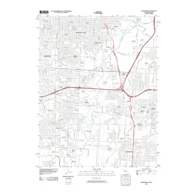
2009 Map of Grandview
USGS Topo · Published 2009About this map
The Blue River corridor and its network of tributaries, including Indian Creek and Tomahawk Creek, define the topography of this southern Missouri landscape. Historically significant as a crossroads, the area features a blend of established residential neighborhoods and industrial hubs such as Dodson and Flinn. Significant genealogical landmarks are dispersed throughout the region, ranging from the Grange Cemetery to the sprawling grounds of Mount Moriah Cemetery.
Find a feature on this map
205 named features on this map. Tap any name to fly to it.
Don’t see what you’re looking for? This feature index may not catch every label — zoom into the map to look around manually.
Map Details
Editions of this 2009 Grandview Map
This is the sole edition of this map. No revisions or reprints were ever made.
Other maps of this area

1887 · Harrisonville
USGS Topo · 1:125,000

1887 · Olathe
USGS Topo · 1:125,000

1890 · Kansas City
USGS Topo · 1:125,000

1892 · Harrisonville
USGS Topo · 1:125,000

1893 · Olathe
USGS Topo · 1:125,000

1894 · Kansas City
USGS Topo · 1:125,000

1894 · Harrisonville
USGS Topo · 1:125,000

1894 · Independence
USGS Topo · 1:125,000

1934 · Independence
USGS Topo · 1:24,000

1934 · Grandview
USGS Topo · 1:24,000