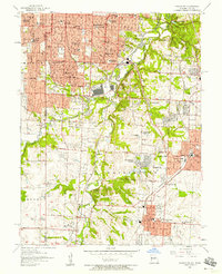
1957 Map of Grandview
USGS Topo · Published 1958About this map
Blue River meanders through the central landscape of this mid-century survey, dividing the suburban expansion of Kansas City and Prairie Village from the more open valley floor. The map captures the rapid post-war growth of southern Jackson County, highlighting established neighborhoods like Waldo and Marlborough alongside newer developments such as Ruskin Heights and Leawood. A significant military presence is documented at the U S Naval Reservation near Bannister Road, while the cultural landscape is defined by a dense concentration of educational and religious institutions, including Kansas City Bible College and St James Seminary. The region's transport network is a complex hub of mid-century infrastructure, where the Kansas City Southern, Missouri Pacific, and St Louis San Francisco railroads intersect, facilitating the movement of goods and people between Grandview and the metropolitan core.
Find a feature on this map
74 named features on this map. Tap any name to fly to it.
Don’t see what you’re looking for? This feature index may not catch every label — zoom into the map to look around manually.
Map Details
Editions of this 1957 Grandview Map
This is the sole edition of this map. No revisions or reprints were ever made.
Other maps of this area

1887 · Harrisonville
USGS Topo · 1:125,000

1887 · Olathe
USGS Topo · 1:125,000

1890 · Kansas City
USGS Topo · 1:125,000

1892 · Harrisonville
USGS Topo · 1:125,000

1893 · Olathe
USGS Topo · 1:125,000

1894 · Kansas City
USGS Topo · 1:125,000

1894 · Harrisonville
USGS Topo · 1:125,000

1894 · Independence
USGS Topo · 1:125,000

1934 · Independence
USGS Topo · 1:24,000

1934 · Grandview
USGS Topo · 1:24,000