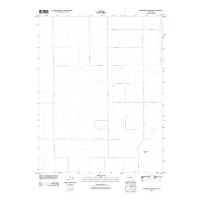
2010 Map of Grandview School SE
USGS Topo · Published 2010About this map
The high plains of eastern Pueblo County are defined by a sparse, geometric grid of rural roads in this 2010 survey. The landscape is dominated by the vast catchment of Big Sand Hole, a distinctive terrain feature in an otherwise strictly partitioned territory of section lines and range boundaries. Major arterial routes like Prairie Hill Rd and E County Line Rd frame the quadrangle, while smaller local roads such as Roy Wright Rd and Boone Hill East Rd provide access to the expansive open range. This map captures the late 20th-century development of the regional road network, including precisely surveyed paths like County Road T and County Road L 5/10, reflecting the organized land management of Colorado's eastern agricultural and ranching corridors.
Find a feature on this map
18 named features on this map. Tap any name to fly to it.
Don’t see what you’re looking for? This feature index may not catch every label — zoom into the map to look around manually.
Map Details
Editions of this 2010 Grandview School SE Map
This is the sole edition of this map. No revisions or reprints were ever made.
Other maps of this area

1891 · Catlin
USGS Topo · 1:125,000

1891 · Nepesta
USGS Topo · 1:125,000

1893 · Nepesta
USGS Topo · 1:125,000

1893 · Catlin
USGS Topo · 1:125,000

1904 · Nepesta
USGS Topo · 1:125,000

1954 · Olney Springs
USGS Topo · 1:24,000

1954 · Lamar
USGS Topo · 1:250,000

1954 · Pueblo
USGS Topo · 1:250,000

1957 · Pueblo
USGS Topo · 1:250,000

1958 · Pueblo
USGS Topo · 1:250,000