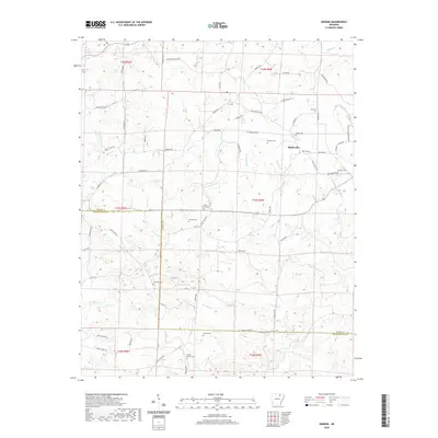
2020 Map of Grange
USGS Topo · Published 2020About this map
The border between Sharp and Independence Counties bisects this landscape, which is defined by the headwaters of numerous creeks and a dense network of family-named cemeteries. The small communities of Grange and Shelbyville serve as local hubs, connected by a web of rural routes including Shelbyville Rd and Grange Rd. The terrain is deeply etched by the various branches of Reeds Creek, including North Prong and South Prong, which converge as they flow through the central part of the quadrangle. For genealogists and local historians, the sheer number of documented burial sites, such as Roe Cem, Parsley Cem, and Rawlings Cem, offers a detailed map of early family settlement patterns across these rural Arkansas hills. The southern reaches are marked by the winding paths of Devils Fork and Curia Creek near Cedar Grove Cem.
Find a feature on this map
71 named features on this map. Tap any name to fly to it.
Don’t see what you’re looking for? This feature index may not catch every label — zoom into the map to look around manually.
Map Details
Editions of this 2020 Grange Map
This is the sole edition of this map. No revisions or reprints were ever made.
Other maps of this area

1890 · Batesville
USGS Topo · 1:125,000

1891 · Batesville
USGS Topo · 1:125,000

1932 · Strawberry
USGS Topo · 1:62,500

1935 · Strawberry
USGS Topo · 1:62,500

1941 · Strawberry
USGS Topo · 1:62,500

1943 · Cave City
USGS Topo · 1:31,680

1943 · Sulphur Rock
USGS Topo · 1:31,680

1953 · Memphis
USGS Topo · 1:250,000

1954 · Charlotte
USGS Topo · 1:24,000

1955 · Strawberry
USGS Topo · 1:24,000