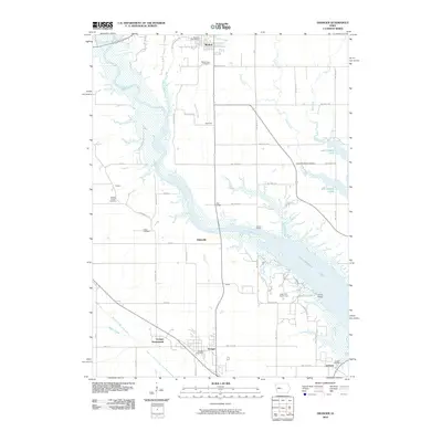
2010 Map of Granger
USGS Topo · Published 2010About this map
Saylorville Lake and Big Creek Lake dominate the landscape of central Iowa in this 2010 study, where the Des Moines River flows through a series of significant water management projects. To the north, the town of Madrid sits near the Madrid Post Office, while the southern portion of the map is anchored by the community of Granger. The area is marked by a high density of small burial grounds that speak to the long-standing agricultural roots of Polk and Boone counties, including Mount Hope Cemetery, Snider Cemetery, and the United Bretheran Cemetery. Infrastructure like the High Bridge and Snyder Bridge cross the valley, connecting outlying settlements such as Zook Spur and Gibbsville. South of the lake, Granger Homesteads and the Jester Park Golf Course indicate modern residential and recreational developments near the confluence of Beaver Creek.
Find a feature on this map
50 named features on this map. Tap any name to fly to it.
Don’t see what you’re looking for? This feature index may not catch every label — zoom into the map to look around manually.
Map Details
Editions of this 2010 Granger Map
This is the sole edition of this map. No revisions or reprints were ever made.
Other maps of this area

1905 · Des Moines
USGS Topo · 1:62,500

1907 · Des Moines
USGS Topo · 1:62,500

1908 · Waukee
USGS Topo · 1:62,500

1911 · Madrid
USGS Topo · 1:62,500

1911 · Slater
USGS Topo · 1:62,500

1913 · Slater
USGS Topo · 1:62,500

1914 · Madrid
USGS Topo · 1:62,500

1954 · Des Moines
USGS Topo · 1:250,000

1956 · Des Moines
USGS Topo · 1:250,000

1956 · Des Moines NW
USGS Topo · 1:24,000