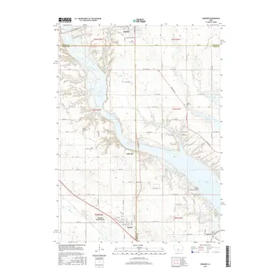
2015 Map of Granger
USGS Topo · Published 2015About this map
The Des Moines River corridor dominates this central Iowa landscape, carving a broad valley through the junction of Boone, Dallas, and Polk Counties. In this 2015 perspective, the river's flow is punctuated by the massive expanses of Saylorville Lake and Big Creek Lake, reflecting the mid-century engineering that transformed the local topography. Away from the water, the grid of Iowa farm roads connects the established towns of Madrid and Granger, while smaller historical points like Gibbsville and Andrews remain on the map. For genealogists and local historians, the sheet preserves the locations of several community burial grounds, including the Hopkins Grove Cem and Snider Cem. The inclusion of the Granger Homesteads provides a look at local residential development patterns south of the river, while the Hanley Bridge crossing serves as a key landmark in the valley's transportation network.
Find a feature on this map
77 named features on this map. Tap any name to fly to it.
Don’t see what you’re looking for? This feature index may not catch every label — zoom into the map to look around manually.
Map Details
Editions of this 2015 Granger Map
This is the sole edition of this map. No revisions or reprints were ever made.
Other maps of this area

1905 · Des Moines
USGS Topo · 1:62,500

1907 · Des Moines
USGS Topo · 1:62,500

1908 · Waukee
USGS Topo · 1:62,500

1911 · Madrid
USGS Topo · 1:62,500

1911 · Slater
USGS Topo · 1:62,500

1913 · Slater
USGS Topo · 1:62,500

1914 · Madrid
USGS Topo · 1:62,500

1954 · Des Moines
USGS Topo · 1:250,000

1956 · Des Moines
USGS Topo · 1:250,000

1956 · Des Moines NW
USGS Topo · 1:24,000