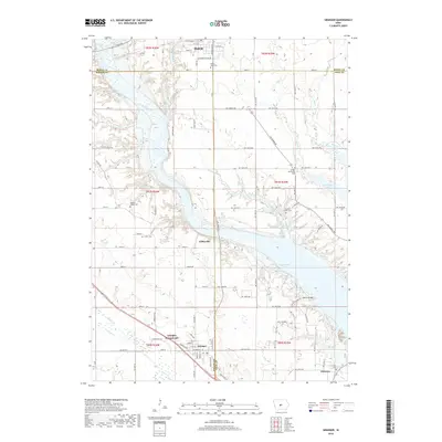
2018 Map of Granger
USGS Topo · Published 2018About this map
Madrid sits at the northern edge of this landscape, where the prairie begins to break toward the valley carved by the Des Moines River. This river corridor serves as the central geographic feature, widening significantly as it enters the headwaters of Saylorville Lake. The settlement patterns here reflect a mix of established towns and smaller agrarian clusters like Gibbsville and the Granger Homesteads. Local history and genealogy are anchored by numerous rural burial sites scattered throughout the terrain, including Mount Hope Cem, Snider Cem, and Hopkins Grove Cem.
Find a feature on this map
65 named features on this map. Tap any name to fly to it.
Don’t see what you’re looking for? This feature index may not catch every label — zoom into the map to look around manually.
Map Details
Editions of this 2018 Granger Map
This is the sole edition of this map. No revisions or reprints were ever made.
Other maps of this area

1905 · Des Moines
USGS Topo · 1:62,500

1907 · Des Moines
USGS Topo · 1:62,500

1908 · Waukee
USGS Topo · 1:62,500

1911 · Madrid
USGS Topo · 1:62,500

1911 · Slater
USGS Topo · 1:62,500

1913 · Slater
USGS Topo · 1:62,500

1914 · Madrid
USGS Topo · 1:62,500

1954 · Des Moines
USGS Topo · 1:250,000

1956 · Des Moines
USGS Topo · 1:250,000

1956 · Des Moines NW
USGS Topo · 1:24,000