2022 Map of Granger
USGS Topo · Published 2022About this map
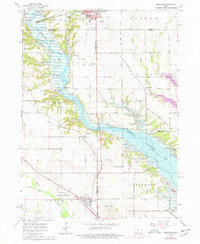
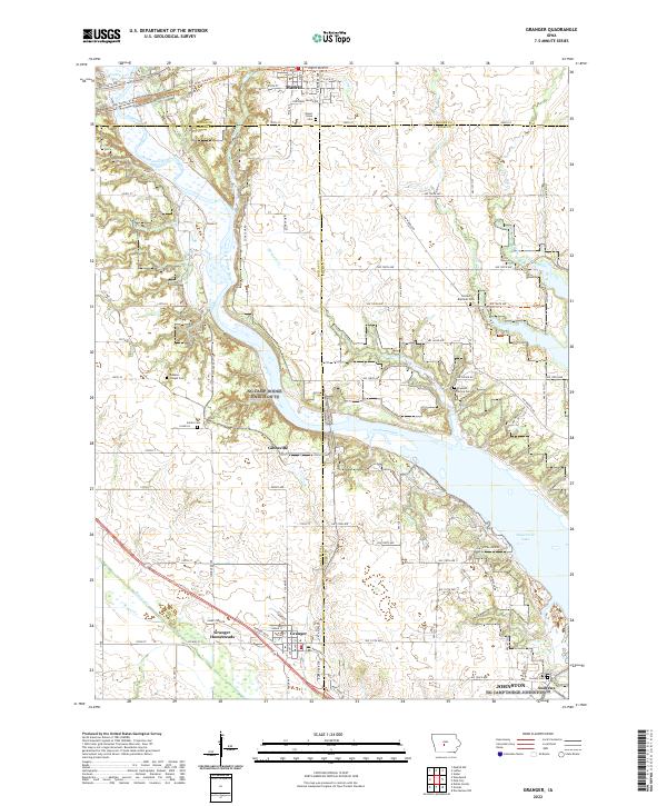
The Des Moines River carves a central path through this landscape, where the borders of Boone, Dallas, and Polk counties meet. To the south, the community of Granger is anchored by the Granger Homesteads, a notable New Deal-era subsistence project established in the 1930s to provide coal miners with small agricultural tracts. This 2022 survey captures the modern geography of the region, including the expansion of Saylorville Lake and the recreational development of the High Trestle Trl which follows a legacy rail corridor.
Find a feature on this map
76 named features on this map. Tap any name to fly to it.
Don’t see what you’re looking for? This feature index may not catch every label — zoom into the map to look around manually.
Map Details
Editions of this 2022 Granger Map
This is the sole edition of this map. No revisions or reprints were ever made.