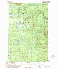
1989 Map of Granite Falls
USGS Topo · Published 1989About this map
Granite Falls sits at the convergence of rugged Cascades foothills and river-cut lowlands during the late 1980s. The town's layout includes established residential blocks alongside a Trailer Park and the local Cem, with industrial activity marked by a nearby Quarry and Gravel Pit. The landscape is defined by the winding South Fork Stillaguamish River and the Pilchuck River, which flow around the prominent elevation of Iron Mountain.
Find a feature on this map
35 named features on this map. Tap any name to fly to it.
Don’t see what you’re looking for? This feature index may not catch every label — zoom into the map to look around manually.
Map Details
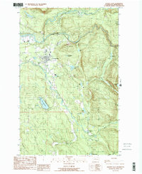
Editions of this 1989 Granite Falls Map
2 editions found
Other maps of this area

1895 · Snohomish
USGS Topo · 1:125,000

1897 · Seattle
USGS Topo · 1:125,000

1899 · Stillaguamish
USGS Topo · 1:125,000

1901 · Stilaguamish
USGS Topo · 1:125,000

1911 · Mount Vernon
USGS Topo · 1:125,000

1921 · Sultan
USGS Topo · 1:125,000

1923 · Sultan
USGS Topo · 1:125,000

1941 · Marysville
USGS Topo · 1:62,500

1943 · Marysville
USGS Topo · 1:62,500

1944 · Everett
USGS Topo · 1:62,500