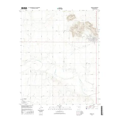
2016 Map of Granite
USGS Topo · Published 2016About this map
Headquarters Mtn and the surrounding peaks of Walsh Mtn and Brown Mtn dominate the northeastern landscape of this Greer County region. At the base of these heights, the town of Granite is laid out on a grid including Parker Ave and Mountain Ave, serving as a gateway to the rocky terrain. The southern portion of the map transitions to the lower elevation drainage of the Elm Fork Red River, where the river’s braided channels and the oxbow Horseshoe Lake define the riparian environment. Local history is anchored by the Rock Cem and Lutheran Cem, while the northern outskirts of Mangum appear in the southwest corner. The map reflects a landscape of significant elevation changes, from the sharp granite rises in the north to the wide, sediment-filled river valley in the south, connected by a network of rural section-line roads like E1430 Rd and N1980 Rd.
Find a feature on this map
42 named features on this map. Tap any name to fly to it.
Don’t see what you’re looking for? This feature index may not catch every label — zoom into the map to look around manually.
Map Details
Editions of this 2016 Granite Map
This is the sole edition of this map. No revisions or reprints were ever made.
Other maps of this area

1955 · Lawton
USGS Topo · 1:250,000

1955 · Clinton
USGS Topo · 1:250,000

1957 · Clinton
USGS Topo · 1:250,000

1961 · Willow
USGS Topo · 1:62,500

1961 · Retrop
USGS Topo · 1:62,500

1971 · Blair
USGS Topo · 1:24,000

1971 · Mangum North
USGS Topo · 1:24,000

1971 · Granite
USGS Topo · 1:24,000

1971 · Mangum South
USGS Topo · 1:24,000

1971 · Hester
USGS Topo · 1:24,000