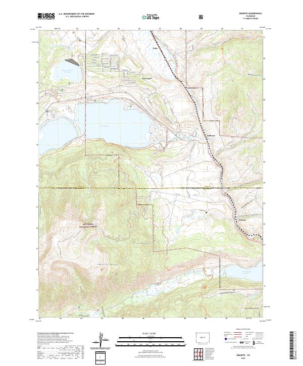
2022 Map of Granite
USGS Topo · Published 2022About this map
The Arkansas River carves a path through this high-altitude landscape, where the Sawatch Range meets the developed waterways of the Upper Arkansas Valley. At the edge of the San Isabel National Forest, the settlement of Granite sits near the crossing of the river, marked by the nearby Granite Cem and historical transit routes like the Old Stagecoach Road Trl. This area serves as a critical junction for water management, featuring the Mount Elbert Forebay and the expanded waters of Twin Lakes, which reflect the engineering demands of the region's reservoirs.
Find a feature on this map
80 named features on this map. Tap any name to fly to it.
Don’t see what you’re looking for? This feature index may not catch every label — zoom into the map to look around manually.
Map Details
Editions of this 2022 Granite Map
This is the sole edition of this map. No revisions or reprints were ever made.
Other maps of this area

1889 · Leadville
USGS Topo · 1:125,000

1891 · Leadville
USGS Topo · 1:125,000

1935 · Mount Elbert
USGS Topo · 1:62,500

1938 · Mount Elbert
USGS Topo · 1:62,500

1939 · Mount Elbert
USGS Topo · 1:62,500

1942 · Leadville
USGS Topo · 1:125,000

1955 · Buena Vista
USGS Topo · 1:62,500

1955 · Mount Harvard
USGS Topo · 1:62,500

1956 · Montrose
USGS Topo · 1:250,000

1957 · Leadville
USGS Topo · 1:250,000