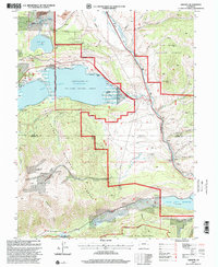
1994 Map of Granite
USGS Topo · Published 2001About this map
The Arkansas River serves as the central artery through this mountainous corridor, where industrial water management and historic preservation intersect. The high-elevation landscape is anchored by the Twin Lakes Reservoir and Clear Creek Reservoir, which, along with the Mount Elbert Forebay and Mt Elbert Powerplant, reflect the mid-century infrastructure developments in the region. These modern utility features sit alongside the preserved Interlaken Historic Site on the southern shore of Twin Lakes, marking the area's earlier role as a resort destination.
Find a feature on this map
41 named features on this map. Tap any name to fly to it.
Don’t see what you’re looking for? This feature index may not catch every label — zoom into the map to look around manually.
Map Details
Editions of this 1994 Granite Map
This is the sole edition of this map. No revisions or reprints were ever made.
Other maps of this area

1889 · Leadville
USGS Topo · 1:125,000

1891 · Leadville
USGS Topo · 1:125,000

1935 · Mount Elbert
USGS Topo · 1:62,500

1938 · Mount Elbert
USGS Topo · 1:62,500

1939 · Mount Elbert
USGS Topo · 1:62,500

1942 · Leadville
USGS Topo · 1:125,000

1955 · Buena Vista
USGS Topo · 1:62,500

1955 · Mount Harvard
USGS Topo · 1:62,500

1956 · Montrose
USGS Topo · 1:250,000

1957 · Leadville
USGS Topo · 1:250,000