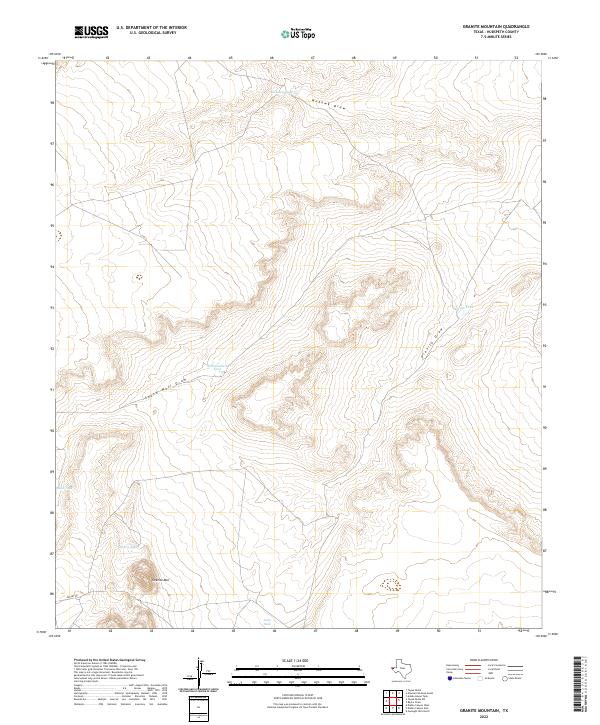
2022 Map of Granite Mountain
USGS Topo · Published 2022About this map
Granite Mtn rises as a significant landmark in this arid stretch of Hudspeth County, serving as a focal point for the surrounding desert hydrology. The landscape is defined by a network of seasonal watercourses, including Mohawk Draw and South Well Draw, which cut through the terrain. Human presence is marked primarily by infrastructure for water management, essential for ranching in this environment. Named collection points like Williamsburg Tank, Mohawk Tank, and Granite Tank are distributed across the quadrangle, illustrating the strategic importance of surface water storage. The passage of Mosley Rd in the southwest corner provides the primary terrestrial link through this remote area, where the topography transitions between broad basins and the elevated relief of the mountain. This 2022 survey demonstrates the enduring reliance on these localized geographic features for land navigation and livestock management.
Find a feature on this map
10 named features on this map. Tap any name to fly to it.
Don’t see what you’re looking for? This feature index may not catch every label — zoom into the map to look around manually.
Map Details
Editions of this 2022 Granite Mountain Map
This is the sole edition of this map. No revisions or reprints were ever made.
Other maps of this area

1894 · Fort Hancock
USGS Topo · 1:125,000

1895 · Sierra Blanca
USGS Topo · 1:125,000

1903 · Cerro Alto
USGS Topo · 1:125,000

1943 · Tepee Butte
USGS Topo · 1:62,500

1943 · Finlay Mountains
USGS Topo · 1:62,500

1948 · Triple Hill
USGS Topo · 1:62,500

1951 · Red Hills
USGS Topo · 1:62,500

1954 · Van Horn
USGS Topo · 1:250,000

1958 · Van Horn
USGS Topo · 1:250,000
1977 · Diablo Canyon East
USGS Topo · 1:24,000