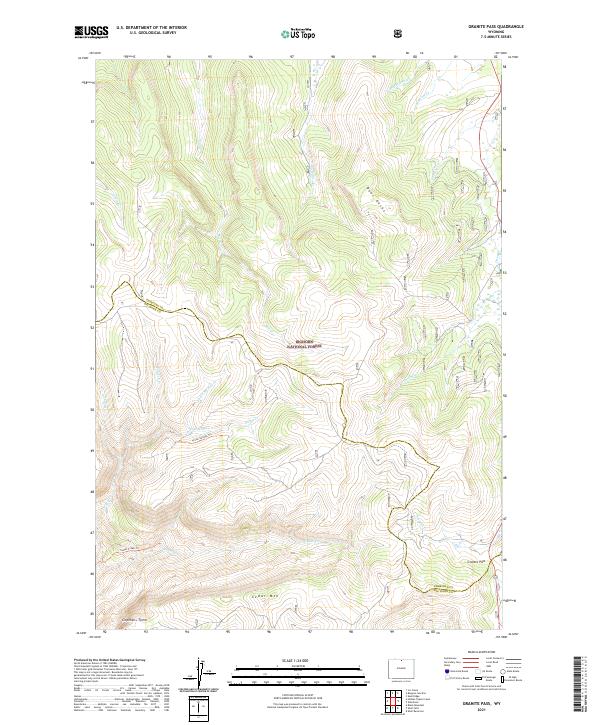
2021 Map of Granite Pass
USGS Topo · Published 2021About this map
Bighorn National Forest lands dominate this high-altitude survey along the border of Sheridan and Big Horn Counties. The map is centered on a dramatic divide of water and terrain, where the crest of Cedar Mtn and the sheer face of Copmans Tomb overlook a complex network of drainages. The hydrology of the area is defined by the headwaters of Big Willow Cr and Bull Cr, which carve through the elevations near Bear Rocks. Modern recreation and traditional access are preserved through named routes like the Three Springs Trl and Cedar Creek Trl. The inclusion of Granite Pass at the eastern edge provides a crucial orientation point for this remote mountain landscape, which remains largely defined by its natural features and surveyed township boundaries rather than permanent settlements.
Find a feature on this map
27 named features on this map. Tap any name to fly to it.
Don’t see what you’re looking for? This feature index may not catch every label — zoom into the map to look around manually.
Map Details
Editions of this 2021 Granite Pass Map
This is the sole edition of this map. No revisions or reprints were ever made.
Other maps of this area

1895 · Dayton
USGS Topo · 1:125,000

1898 · Bald Mountain
USGS Topo · 1:125,000

1901 · Dayton
USGS Topo · 1:125,000

1901 · Bald Mountain
USGS Topo · 1:125,000

1955 · Sheridan
USGS Topo · 1:250,000

1958 · Sheridan
USGS Topo · 1:250,000

1960 · Shell Falls
USGS Topo · 1:24,000

1960 · Black Mountain
USGS Topo · 1:24,000

1960 · Granite Pass
USGS Topo · 1:24,000

1960 · Hidden Tepee Creek
USGS Topo · 1:24,000