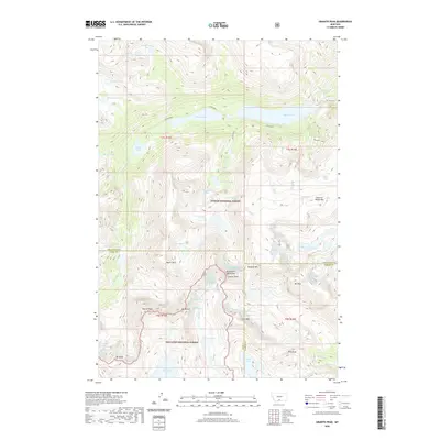
2020 Map of Granite Peak
USGS Topo · Published 2020About this map
Granite Peak and the surrounding heights of the Beartooth Mountains dominate this high-altitude landscape along the boundaries of Custer National Forest and Gallatin National Forest. The map detail captures the convergence of Park, Stillwater, and Carbon counties at these high summits, illustrating a wilderness shaped by massive peaks like Mystic Mtn, Tempest Mtn, and Mt Villard.
Find a feature on this map
43 named features on this map. Tap any name to fly to it.
Don’t see what you’re looking for? This feature index may not catch every label — zoom into the map to look around manually.
Map Details
Editions of this 2020 Granite Peak Map
This is the sole edition of this map. No revisions or reprints were ever made.
Other maps of this area

1898 · Granite Mountain District
USGS Topo · 1:125,000

1932 · Nye No 1
USGS Topo · 1:48,000

1932 · Nye No 2
USGS Topo · 1:48,000

1939 · Mt Wood
USGS Topo · 1:62,500

1941 · Mt. Wood
USGS Topo · 1:62,500

1954 · Billings
USGS Topo · 1:250,000
1956 · Emerald Lake
USGS Topo · 1:24,000

1956 · Alpine
USGS Topo · 1:62,500

1956 · Cooke City
USGS Topo · 1:62,500

1957 · Billings
USGS Topo · 1:250,000