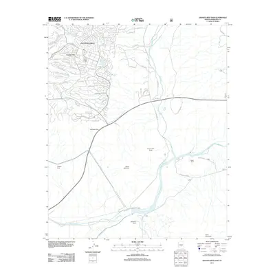
2011 Map of Granite Reef Dam
USGS Topo · Published 2011About this map
Granite Reef Dam serves as the focal point where the Verde River and Salt River converge, orchestrating a complex network of desert water management. This 2011 survey documents the engineered landscape of the Phoenix Valley, highlighting the massive Central Arizona Project Aqueduct as it cuts across the arid terrain. The map captures the suburban expansion of Fountain Hills, including the Fountain Hills Post Office and the Fountain Hills Golf Course, while preserving the names of rugged natural landmarks like Mount McDowell and Schlechts Butte. The presence of the Arizona Canal and Southern Canal illustrates the ongoing reliance on irrigation systems that have sustained this region since the early twentieth century. This edition provides a clear view of the intersection between modern residential development and the critical infrastructure required to move water through the desert.
Find a feature on this map
70 named features on this map. Tap any name to fly to it.
Don’t see what you’re looking for? This feature index may not catch every label — zoom into the map to look around manually.
Map Details
Editions of this 2011 Granite Reef Dam Map
This is the sole edition of this map. No revisions or reprints were ever made.
Other maps of this area

1904 · Camelback
USGS Topo · 1:62,500

1904 · Desert Well
USGS Topo · 1:62,500

1904 · Ft. McDowell
USGS Topo · 1:62,500

1906 · Camelsback
USGS Topo · 1:62,500

1906 · Ft. McDowell
USGS Topo · 1:62,500

1906 · Desert Well
USGS Topo · 1:62,500

1913 · Mesa
USGS Topo · 1:62,500

1915 · Mesa
USGS Topo · 1:62,500

1930 · Cave Creek
USGS Topo · 1:125,000

1939 · Cave Creek
USGS Topo · 1:125,000