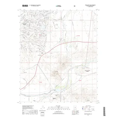
2018 Map of Granite Reef Dam
USGS Topo · Published 2018About this map
The Verde River and Salt River converge at a critical junction of Arizona's water infrastructure, anchored by the Granite Reef Dam. This modern survey illustrates the complex hydraulic network serving the Salt River Valley, where the Arizona Canal and Southern Canal divert water to sustain the growing desert communities. The terrain is defined by dramatic elevations like Mt McDowell and Apache Peak, which overlook the expanding residential footprints of Fountain Hills and the northern reaches of Mesa.
Find a feature on this map
140 named features on this map. Tap any name to fly to it.
Don’t see what you’re looking for? This feature index may not catch every label — zoom into the map to look around manually.
Map Details
Editions of this 2018 Granite Reef Dam Map
This is the sole edition of this map. No revisions or reprints were ever made.
Other maps of this area

1904 · Camelback
USGS Topo · 1:62,500

1904 · Desert Well
USGS Topo · 1:62,500

1904 · Ft. McDowell
USGS Topo · 1:62,500

1906 · Camelsback
USGS Topo · 1:62,500

1906 · Ft. McDowell
USGS Topo · 1:62,500

1906 · Desert Well
USGS Topo · 1:62,500

1913 · Mesa
USGS Topo · 1:62,500

1915 · Mesa
USGS Topo · 1:62,500

1930 · Cave Creek
USGS Topo · 1:125,000

1939 · Cave Creek
USGS Topo · 1:125,000