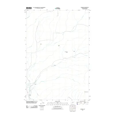
2011 Map of Grannis
USGS Topo · Published 2011About this map
The Shields River valley defines the southwestern corner of this Montana landscape, where the settlement of Grannis sits near an intricate network of irrigation channels. Agriculture and ranching dictate the human footprint here, evidenced by established family holdings like Bohleen Ranch, Bonhomme Ranch, and Hetzel Ranch. Water management is central to the area's development, with the Palmer Ditch and Lower Shields Valley Ditch drawing from the river to support local operations. To the north and east, the terrain rises into the foothills, marked by prominent features such as Rattlesnake Ridge and Sheep Mountain. Numerous seasonal and perennial waterways, including Adair Creek, Bullrun Creek, and Tobin Creek, carve through the heights, connecting the uplands to the primary river drainage below. This survey captures a moment in the modern ranching era of Park County, showing the persistent relationship between these high-plains water sources and the land.
Find a feature on this map
22 named features on this map. Tap any name to fly to it.
Don’t see what you’re looking for? This feature index may not catch every label — zoom into the map to look around manually.
Map Details
Editions of this 2011 Grannis Map
This is the sole edition of this map. No revisions or reprints were ever made.
Other maps of this area

1891 · Livingston
USGS Topo · 1:250,000

1893 · Livingston
USGS Topo · 1:250,000

1947 · Bozeman
USGS Topo · 1:250,000

1948 · Bozeman
USGS Topo · 1:250,000

1951 · Ibex Mountain
USGS Topo · 1:24,000

1951 · Clyde Park
USGS Topo · 1:24,000

1951 · Chadborn
USGS Topo · 1:24,000

1951 · Grannis
USGS Topo · 1:24,000

1951 · Hunters Hot Springs
USGS Topo · 1:24,000

1951 · Elton
USGS Topo · 1:24,000