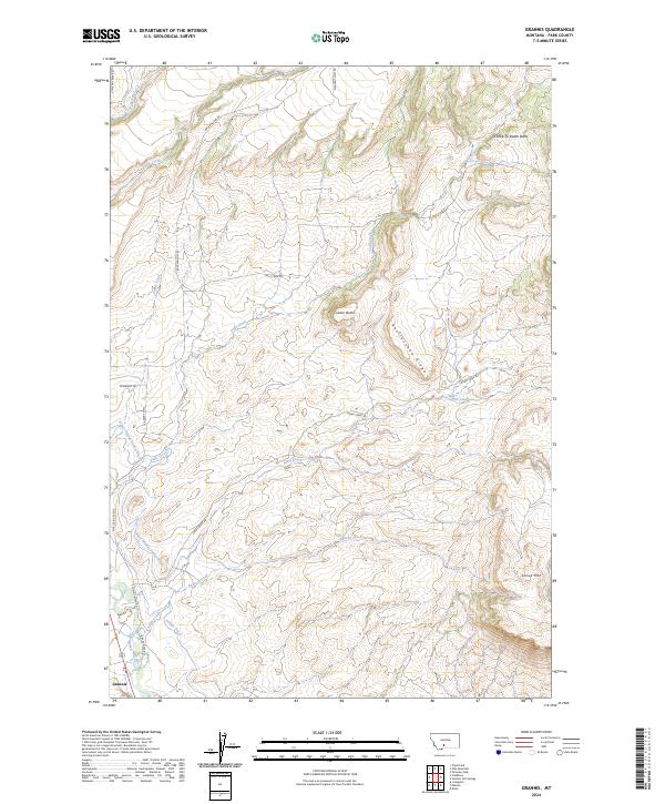
2024 Map of Grannis
USGS Topo · Published 2024About this map
Grannis sits at the southwestern edge of this landscape, positioned where the Shields River valley meets the rising topography of the northern Park County area. The map illustrates a high-altitude agricultural and ranching environment defined by an intricate network of water management, including the Lower Shields Valley Ditch and Palmer Ditch, which redirect water from the river to the lower-lying lands. To the east, the terrain ascends sharply toward prominent landmarks like Cedar Butte and the evocative Choke-To-Death Butte, while Rattlesnake Ridge and Sheep Mtn dominate the eastern horizon. Numerous drainages such as Bullrun Creek, Adair Creek, and Falls Creek carve through the foothills, following the natural contours toward the river. This survey documents the modern layout of rural roads, such as Shields River Rd and Adair Creek Rd, that facilitate access across this complex drainage basin.
Find a feature on this map
30 named features on this map. Tap any name to fly to it.
Don’t see what you’re looking for? This feature index may not catch every label — zoom into the map to look around manually.
Map Details
Editions of this 2024 Grannis Map
This is the sole edition of this map. No revisions or reprints were ever made.
Other maps of this area

1891 · Livingston
USGS Topo · 1:250,000

1893 · Livingston
USGS Topo · 1:250,000

1947 · Bozeman
USGS Topo · 1:250,000

1948 · Bozeman
USGS Topo · 1:250,000

1951 · Ibex Mountain
USGS Topo · 1:24,000

1951 · Clyde Park
USGS Topo · 1:24,000

1951 · Chadborn
USGS Topo · 1:24,000

1951 · Grannis
USGS Topo · 1:24,000

1951 · Hunters Hot Springs
USGS Topo · 1:24,000

1951 · Elton
USGS Topo · 1:24,000