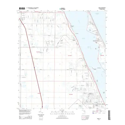
2015 Map of Grant
USGS Topo · Published 2015About this map
The Indian River Lagoon and its complex system of islands and points dominate this portion of the Florida coast, where the Intracoastal Waterway cuts through the wide expanse of the Indian River. The landscape is defined by the transition from the upland pinewoods of Jordan Scrub to the water-level communities of Valkaria, Grant, and Micco. This era of the mid-2010s shows a structured grid of residential development extending west from the coast, though large tracts remain dominated by wetlands and creeks like Kid Cr and Cypress Creek. Aviation history is represented by the Valkaria Airport, while the shoreline features numerous family-named landmarks such as Washburn Cove and Gibbs Point. Offshore, several named landforms including Grant Farm Island and Grange Island sit at the mouth of smaller tributaries, marking the delicate geography of the lagoon system.
Find a feature on this map
166 named features on this map. Tap any name to fly to it.
Don’t see what you’re looking for? This feature index may not catch every label — zoom into the map to look around manually.
Map Details
Editions of this 2015 Grant Map
This is the sole edition of this map. No revisions or reprints were ever made.
Other maps of this area

1949 · Melbourne West
USGS Topo · 1:24,000

1949 · Fellsmere
USGS Topo · 1:24,000

1949 · Melbourne East
USGS Topo · 1:24,000

1949 · Sebastian NW
USGS Topo · 1:24,000

1949 · Sebastian
USGS Topo · 1:24,000

1949 · Grant
USGS Topo · 1:24,000

1951 · Sebastian NW
USGS Topo · 1:24,000

1951 · Melbourne East
USGS Topo · 1:24,000

1951 · Fellsmere
USGS Topo · 1:24,000

1951 · Melbourne West
USGS Topo · 1:24,000