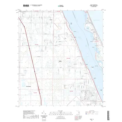
2021 Map of Grant
USGS Topo · Published 2021About this map
Grant-Valkaria and the surrounding coastal communities of Malabar and Palm Bay are defined by their orientation to the Indian River Lagoon. This modern survey illustrates the persistent importance of the Intracoastal Waterway and the complex shoreline of the Indian River, featuring numerous named points and coves like North Rocky Point and Hog Point Cove. The landscape transitions from the urbanized residential grids of Palm Bay to the protected wetlands of the Jordan Scrub Sanctuary Trl and Grant Woods Sanctuary Trl.
Find a feature on this map
168 named features on this map. Tap any name to fly to it.
Don’t see what you’re looking for? This feature index may not catch every label — zoom into the map to look around manually.
Map Details
Editions of this 2021 Grant Map
This is the sole edition of this map. No revisions or reprints were ever made.
Other maps of this area

1949 · Melbourne West
USGS Topo · 1:24,000

1949 · Fellsmere
USGS Topo · 1:24,000

1949 · Melbourne East
USGS Topo · 1:24,000

1949 · Sebastian NW
USGS Topo · 1:24,000

1949 · Sebastian
USGS Topo · 1:24,000

1949 · Grant
USGS Topo · 1:24,000

1951 · Sebastian NW
USGS Topo · 1:24,000

1951 · Melbourne East
USGS Topo · 1:24,000

1951 · Fellsmere
USGS Topo · 1:24,000

1951 · Melbourne West
USGS Topo · 1:24,000