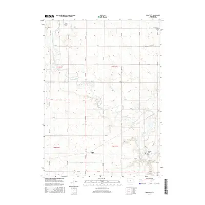
2015 Map of Grant City
USGS Topo · Published 2015About this map
The North Raccoon River snakes through this section of Sac County, Iowa, defining a landscape shaped by both natural waterways and a complex system of engineered drainage like Drainage Ditch 73 and Drainage Ditch 31. This grid-heavy rural environment is anchored by the small settlements of Grant City and Auburn in the southeast, while the hamlet of Ulmer sits centrally along Union Ave. The map reveals a high concentration of heritage sites, particularly for those tracing local family roots through numerous denominational burial grounds such as Saint Peters Lutheran Cem, Oak Lawn Cem, and Saint Marys Cem. Near the northern border, the Sac City Municipal Airport stands as a modern landmark amidst the traditional section-line roads and agricultural fields that have long characterized this portion of the Iowa plains.
Find a feature on this map
45 named features on this map. Tap any name to fly to it.
Don’t see what you’re looking for? This feature index may not catch every label — zoom into the map to look around manually.
Map Details
Editions of this 2015 Grant City Map
This is the sole edition of this map. No revisions or reprints were ever made.
Other maps of this area

1954 · Fort Dodge
USGS Topo · 1:250,000

1957 · Fort Dodge
USGS Topo · 1:250,000

1958 · Fort Dodge
USGS Topo · 1:250,000

1980 · Lytton
USGS Topo · 1:24,000

1980 · Sac City East
USGS Topo · 1:24,000

1980 · Breda
USGS Topo · 1:24,000

1980 · Grant City
USGS Topo · 1:24,000

1980 · Carroll NE
USGS Topo · 1:24,000

1980 · Yetter
USGS Topo · 1:24,000

1980 · Lake View
USGS Topo · 1:24,000