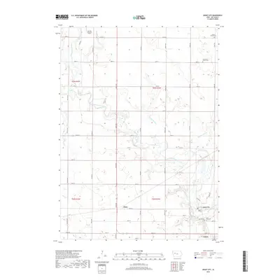
2018 Map of Grant City
USGS Topo · Published 2018About this map
The North Raccoon River carves a winding path through the heart of this Sac County landscape, its natural meanders contrasted by a strictly organized grid of agricultural section lines and engineered water management features like Drainage Ditch 25 and Drainage Ditch 31. The settlement of Auburn sits at the southern edge, while the historic site of Grant City is located near the river's bend, flanked by a cluster of community burial grounds including Oak Lawn Cem and Saint Marys Cem. Further north, the isolated grain elevator site at Ulmer and the Sac City Municipal Airport reflect the region's enduring ties to aviation and commercial transport. This 2018 survey detail provides an essential record for genealogists tracing family ties to the Lutheran Emanuel Cem or Saint Peters Lutheran Cem in the rural townships north of the river.
Find a feature on this map
43 named features on this map. Tap any name to fly to it.
Don’t see what you’re looking for? This feature index may not catch every label — zoom into the map to look around manually.
Map Details
Editions of this 2018 Grant City Map
This is the sole edition of this map. No revisions or reprints were ever made.
Other maps of this area

1954 · Fort Dodge
USGS Topo · 1:250,000

1957 · Fort Dodge
USGS Topo · 1:250,000

1958 · Fort Dodge
USGS Topo · 1:250,000

1980 · Lytton
USGS Topo · 1:24,000

1980 · Sac City East
USGS Topo · 1:24,000

1980 · Breda
USGS Topo · 1:24,000

1980 · Grant City
USGS Topo · 1:24,000

1980 · Carroll NE
USGS Topo · 1:24,000

1980 · Yetter
USGS Topo · 1:24,000

1980 · Lake View
USGS Topo · 1:24,000