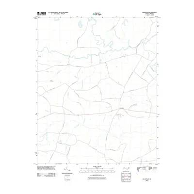
2010 Map of Grantham
USGS Topo · Published 2010About this map
The Neuse River winds through the northern portion of this Wayne County landscape, defining a terrain shaped by its numerous tributaries and historical crossings. Near the center of the sheet, the settlement of Grantham serves as a local hub, situated at the junction of several established routes. To the northwest, the small community at Cox Mill and the nearby Sylvania Lake Dam reflect the area's long-standing relationship with its water resources, particularly along the winding Mill Creek.
Find a feature on this map
43 named features on this map. Tap any name to fly to it.
Don’t see what you’re looking for? This feature index may not catch every label — zoom into the map to look around manually.
Map Details
Editions of this 2010 Grantham Map
This is the sole edition of this map. No revisions or reprints were ever made.
Other maps of this area

1906 · Four Oaks
USGS Topo · 1:48,000

1908 · Four Oaks
USGS Topo · 1:62,500

1909 · Coharie
USGS Topo · 1:62,500

1953 · Raleigh
USGS Topo · 1:250,000

1954 · Raleigh
USGS Topo · 1:250,000

1974 · Grantham
USGS Topo · 1:24,000

1974 · Northwest Goldsboro
USGS Topo · 1:24,000
1974 · Princeton
USGS Topo · 1:24,000

1974 · Southwest Goldsboro
USGS Topo · 1:24,000
1977 · Mount Olive
USGS Topo · 1:24,000