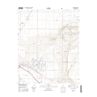
2013 Map of Grants
USGS Topo · Published 2013About this map
The industrial and educational hub of Grants and Milan occupies a high desert landscape defined by striking volcanic geology and the BNSF Railway. This 2013 survey highlights the dense street grid of Grants, stretching from the residential areas of Broadview Acres and Grants Canyon south to the volcanic terrain of The Malpais. The Homestake Mill to the north and the campus of New Mexico State University-Grants emphasize the local transition from mining industry to regional education.
Find a feature on this map
78 named features on this map. Tap any name to fly to it.
Don’t see what you’re looking for? This feature index may not catch every label — zoom into the map to look around manually.
Map Details
Editions of this 2013 Grants Map
This is the sole edition of this map. No revisions or reprints were ever made.
Other maps of this area

1883 · Mt. Taylor
USGS Topo · 1:250,000

1886 · Mt. Taylor
USGS Topo · 1:250,000

1892 · Mt. Taylor
USGS Topo · 1:250,000

1899 · Mt. Taylor
USGS Topo · 1:250,000

1957 · San Rafael
USGS Topo · 1:24,000

1957 · Lobo Springs
USGS Topo · 1:24,000

1957 · Dos Lomas
USGS Topo · 1:24,000

1957 · Grants SE
USGS Topo · 1:24,000

1957 · Bluewater
USGS Topo · 1:24,000

1957 · Mc Cartys
USGS Topo · 1:24,000