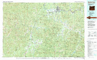
1989 Map of Grants Pass
USGS Topo · Published 1990About this map
Grants Pass serves as the primary hub in this late 1980s look at Southern Oregon, where the Southern Pacific railroad and Interstate 5 follow the path of the Rogue River. The map documents a transition from the urban concentration of the river valley to the dense wilderness of the Siskiyou Mountains. To the southwest, the Illinois Valley hosts a string of smaller settlements like Selma, Kerby, and Cave Junction, which acts as the gateway to the Oregon Caves National Monument. The region’s reliance on its natural resources and topography is evident in the numerous creek-side communities, from Wilderville on the Applegate River to the southern outpost of O'Brien near the California border. Vast protected areas like the Kalmiopsis Wilderness and Siskiyou National Forest dominate the landscape, preserving the rugged character of the Klamath Mountains region.
Find a feature on this map
99 named features on this map. Tap any name to fly to it.
Don’t see what you’re looking for? This feature index may not catch every label — zoom into the map to look around manually.
Map Details
Editions of this 1989 Grants Pass Map
This is the sole edition of this map. No revisions or reprints were ever made.
Other maps of this area

1886 · Shasta
USGS Topo · 1:250,000

1891 · Ashland
USGS Topo · 1:250,000

1893 · Ashland
USGS Topo · 1:250,000

1894 · Shasta
USGS Topo · 1:250,000

1897 · Ashland
USGS Topo · 1:250,000

1899 · Port Orford
USGS Topo · 1:125,000

1903 · Port Orford
USGS Topo · 1:125,000

1904 · Riddle
USGS Topo · 1:125,000

1908 · Grants Pass
USGS Topo · 1:125,000

1914 · Seiad
USGS Topo · 1:125,000