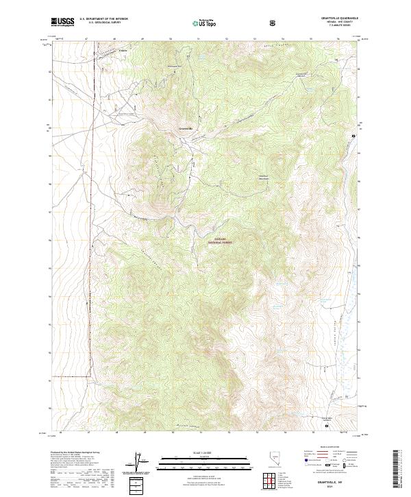
2021 Map of Grantsville
USGS Topo · Published 2021About this map
The Shoshone Mountains dominate this high-altitude landscape within the Toiyabe National Forest, where the historic mining settlement of Grantsville sits at the foot of Grantsville Summit. This area, surveyed recently in 2021, reflects the enduring footprint of Nevada's silver mining era, with the town of Union positioned nearby along the upper reaches of West Union Canyon. The terrain is marked by steep canyons and prominent ridges, including Grantsville Ridge and Richmond Hill, which define the local watershed. Water sources are critical landmarks in this arid environment, noted by numerous named springs such as Wild Carrot Spring, Brush Rabbit Spring, and Indian Garden Spring. To the east, the map transitions into the broad expanse of Indian Valley, where the Cloverdale road provides access toward Cloverdale Summit. The intricate network of canyons—including Patsy Canyon, Milton Canyon, and Spanish Canyon—suggests a complex geography that has historically challenged both miners and ranchers.
Find a feature on this map
48 named features on this map. Tap any name to fly to it.
Don’t see what you’re looking for? This feature index may not catch every label — zoom into the map to look around manually.
Map Details
Editions of this 2021 Grantsville Map
This is the sole edition of this map. No revisions or reprints were ever made.
Other maps of this area

1907 · Tonopah
USGS Topo · 1:250,000

1908 · Tonopah
USGS Topo · 1:250,000

1948 · Ione
USGS Topo · 1:62,500

1950 · Ione
USGS Topo · 1:62,500

1956 · Tonopah
USGS Topo · 1:250,000

1959 · Tonopah
USGS Topo · 1:250,000

1962 · Tonopah
USGS Topo · 1:250,000
1979 · Corral Wash
USGS Topo · 1:24,000
1980 · Black Spring NW
USGS Topo · 1:24,000
1980 · Farrington Canyon
USGS Topo · 1:24,000