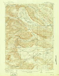
1915 Map of Grass Creek Basin
USGS Topo · Published 1937About this map
Dickie Ranch and several other family homesteads define the high-desert settlement pattern of the Hot Springs region during the early twentieth century. This survey, conducted shortly before the mid-1910s, reveals a landscape dominated by livestock ranching and early mineral extraction. The isolated Putney Mine and the descriptive Coalmine Draw indicate the beginnings of local industry, while an extensive network of watercourses like Wagonhound Creek and Cottonwood Creek dictate the placement of improvements such as the Wales Reservoir. The terrain is sharply delineated by high features like Blue Ridge and the broad Wagonhound Bench, showing how the geography of the Bighorn Basin influenced the spread of early Wyoming settlers and their livestock operations.
Find a feature on this map
25 named features on this map. Tap any name to fly to it.
Don’t see what you’re looking for? This feature index may not catch every label — zoom into the map to look around manually.
Map Details
Editions of this 1915 Grass Creek Basin Map
3 editions found
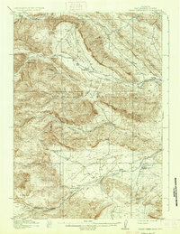
Other maps of this area

1911 · Meeteetse
USGS Topo · 1:62,500

1913 · Meeteetse
USGS Topo · 1:62,500

1913 · Grass Creek Basin
USGS Topo · 1:62,500

1914 · Blue Mesa
USGS Topo · 1:62,500

1915 · Grass Creek Basin
USGS Topo · 1:62,500

1916 · Blue Mesa
USGS Topo · 1:62,500

1951 · Hillberry Rim
USGS Topo · 1:24,000

1951 · Dutch Nick Flat SW
USGS Topo · 1:24,000

1951 · Gillies Draw
USGS Topo · 1:24,000

1955 · Cody
USGS Topo · 1:250,000