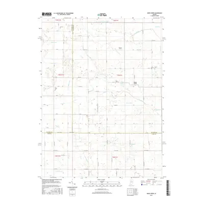
2016 Map of Grass Creek
USGS Topo · Published 2016About this map
The settlement of Grass Creek serves as the focal point for this rural Indiana landscape, situated at the meeting point of Fulton, Cass, and Pulaski Counties. This region is defined by a sophisticated network of agricultural drainage and natural waterways, including Mill Cr, Grassy Cr, and the substantial Indian Cr to the south. The prevalence of established burial sites such as Saint Anns Cem, Bowman Cem, and Victor Chapel Cem provides a rich resource for genealogical research, anchoring family names to specific sections of the township grid. The presence of Plummer Airport and the Nipsco Pipeline Access Rd reflects the modern infrastructure overlaid upon a traditional farming layout, while O'Brien Lake and numerous named ditches illustrate the persistent efforts to manage the local water table for cultivation.
Find a feature on this map
66 named features on this map. Tap any name to fly to it.
Don’t see what you’re looking for? This feature index may not catch every label — zoom into the map to look around manually.
Map Details
Editions of this 2016 Grass Creek Map
This is the sole edition of this map. No revisions or reprints were ever made.
Other maps of this area

1953 · Chicago
USGS Topo · 1:250,000

1953 · Danville
USGS Topo · 1:250,000

1955 · Danville
USGS Topo · 1:250,000

1955 · Logansport
USGS Topo · 1:24,000

1956 · Danville
USGS Topo · 1:250,000

1957 · Chicago
USGS Topo · 1:250,000

1960 · Lucerne
USGS Topo · 1:24,000

1960 · Fulton
USGS Topo · 1:24,000

1960 · Grass Creek
USGS Topo · 1:24,000

1962 · Pershing
USGS Topo · 1:24,000