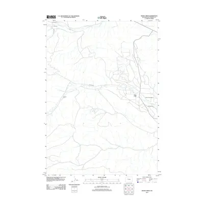
2012 Map of Grass Creek
USGS Topo · Published 2012About this map
Grass Creek serves as a central point in this part of Hot Springs County, situated within the distinctive natural bowl of the Grass Creek Basin. The landscape is defined by its ranching heritage and water management, featuring historic properties like Dickie Ranch, Mayfields Ranch, and the Little John Ranch. This 2012 survey by the U.S. Geological Survey illustrates a network of drainage and irrigation, with Sun Ditch drawing from Gooseberry Cr in the north, while Enos Cr and Left Hand Cr feed into the regional system. The presence of Grass Creek Rd and Dickie Ranch Rd highlights the essential transportation corridors connecting these isolated ranching outposts. This map captures the modern footprint of a rural Wyoming community where the management of water remains as critical as the grazing lands themselves.
Find a feature on this map
13 named features on this map. Tap any name to fly to it.
Don’t see what you’re looking for? This feature index may not catch every label — zoom into the map to look around manually.
Map Details
Editions of this 2012 Grass Creek Map
This is the sole edition of this map. No revisions or reprints were ever made.
Other maps of this area

1911 · Meeteetse
USGS Topo · 1:62,500

1913 · Meeteetse
USGS Topo · 1:62,500

1913 · Grass Creek Basin
USGS Topo · 1:62,500

1915 · Grass Creek Basin
USGS Topo · 1:62,500

1951 · Hillberry Rim
USGS Topo · 1:24,000

1951 · Gillies Draw
USGS Topo · 1:24,000

1955 · Cody
USGS Topo · 1:250,000

1955 · Thermopolis
USGS Topo · 1:250,000

1956 · Twentyone Creek
USGS Topo · 1:24,000

1956 · Adam Weiss Peak
USGS Topo · 1:24,000