
1956 Map of Twentyone Creek
USGS Topo · Published 1958About this map
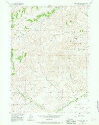
Dickie Ranch and Rhodes Ranch represent the sprawling pastoral character of this Wyoming interior during the mid-1950s. The landscape is defined by a series of significant drainage basins, including the headwaters of Twentyone Creek, Little Grass Creek, and the south-flowing Cottonwood Creek. These water sources supported a remote ranching economy, as evidenced by the presence of both the Rankin Cow Camp and a more generic Cow Camp located further north. While largely a grazing landscape, early energy exploration is visible via a Gas Well near Wagonhound Creek. Geologically, the area transitions from the high prominence of Twin Buttes and Prospect Ridge in the north down toward the wide expanse of Putney Flat in the southeast. Numerous Jeep Trail paths crisscross the terrain, following the natural contours of Dugout Draw and various unnamed springs.
Find a feature on this map
18 named features on this map. Tap any name to fly to it.
Don’t see what you’re looking for? This feature index may not catch every label — zoom into the map to look around manually.
Map Details
Editions of this 1956 Twentyone Creek Map
2 editions found
Other maps of this area

1913 · Grass Creek Basin
USGS Topo · 1:62,500

1915 · Grass Creek Basin
USGS Topo · 1:62,500

1955 · Thermopolis
USGS Topo · 1:250,000

1956 · Milk Creek
USGS Topo · 1:24,000

1956 · Soapy Dale Peak
USGS Topo · 1:24,000

1956 · Adam Weiss Peak
USGS Topo · 1:24,000

1958 · Thermopolis
USGS Topo · 1:250,000

1962 · Thermopolis
USGS Topo · 1:250,000
1965 · Embar
USGS Topo · 1:24,000
1965 · Eagle Nest Ranch
USGS Topo · 1:24,000