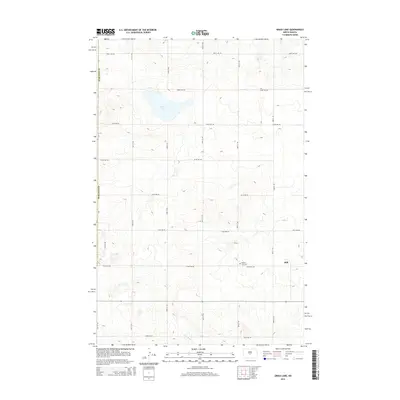
2014 Map of Grass Lake
USGS Topo · Published 2014About this map
Still sits on the eastern edge of this Burleigh County landscape, representing a quiet settlement pattern defined by the rigid grid of section-line roads. The terrain is characterized by the depression of Grass Lake and the winding course of the W Br Apple Cr in the southern reaches. For those researching local history or genealogy, the Mission Free Cem serves as a significant landmark along 318th Ave NE, south of the lake. This 2014 survey documents the enduring rural structure of the region, where infrastructure like 93rd St NE and 396th Ave NE provides the primary framework for the scattered homesteads and agricultural tracts that have shaped this portion of Burleigh Co for generations.
Find a feature on this map
19 named features on this map. Tap any name to fly to it.
Don’t see what you’re looking for? This feature index may not catch every label — zoom into the map to look around manually.
Map Details
Editions of this 2014 Grass Lake Map
This is the sole edition of this map. No revisions or reprints were ever made.
Other maps of this area

1949 · Turtle Creek
USGS Topo · 1:62,500

1950 · Wilton
USGS Topo · 1:62,500

1954 · McClusky
USGS Topo · 1:250,000

1958 · McClusky
USGS Topo · 1:250,000

1959 · Mercer SW
USGS Topo · 1:24,000

1959 · Mercer SE
USGS Topo · 1:24,000

1961 · Turtle Creek SE
USGS Topo · 1:24,000

1966 · Wilton SE
USGS Topo · 1:24,000
1966 · Wilton
USGS Topo · 1:24,000
1975 · Regan SE
USGS Topo · 1:24,000