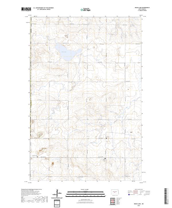
2024 Map of Grass Lake
USGS Topo · Published 2024About this map
Grass Lake occupies a central depression in this northern Burleigh County landscape, where the terrain is defined by a grid of rural section lines and glacial prairie potholes. The settlement of Still sits on the eastern edge of the quadrangle, serving as a focal point for the surrounding agricultural community. The map reveals a pattern of early regional heritage preserved in its cemeteries, including the Sunne Lutheran Cemetery and the Mission Cemetery. A specific nod to the area's extraction history is visible at Mine View Cemetery, which overlooks the undulating topography south of 305th Ave NE. This modern survey tracks the enduring township and range structure across t144n r79w, t143n r79w, and t142n r79w, maintaining the precise spatial organization established during the original land office surveys.
Find a feature on this map
25 named features on this map. Tap any name to fly to it.
Don’t see what you’re looking for? This feature index may not catch every label — zoom into the map to look around manually.
Map Details
Editions of this 2024 Grass Lake Map
This is the sole edition of this map. No revisions or reprints were ever made.
Other maps of this area

1949 · Turtle Creek
USGS Topo · 1:62,500

1950 · Wilton
USGS Topo · 1:62,500

1954 · McClusky
USGS Topo · 1:250,000

1958 · McClusky
USGS Topo · 1:250,000

1959 · Mercer SW
USGS Topo · 1:24,000

1959 · Mercer SE
USGS Topo · 1:24,000

1961 · Turtle Creek SE
USGS Topo · 1:24,000

1966 · Wilton SE
USGS Topo · 1:24,000
1966 · Wilton
USGS Topo · 1:24,000
1975 · Regan SE
USGS Topo · 1:24,000