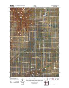
2011 Map of Grass Valley
USGS Topo · Published 2011About this map
Grass Valley serves as the primary hub of this high plateau in north-central Oregon, established at a critical juncture of early local travel routes. The landscape is defined by its agricultural grid and a series of dramatic geographic features, most notably Cottonwood Canyon, Remington Canyon, and Sand Hollow. These deep breaks in the terrain stand in contrast to the orderly arrangement of namesake junctions such as Cooks Corner, Rickmans Corner, and Schillings Corner, which mark the intersection of rural life and land management. The presence of the Michigan Cemetery and the Grass Valley Post Office highlights the enduring community structures that have anchored Sherman County residents for generations. To the south, water resources like Buether Reservoir and the drainage of Finnegan Creek illustrate the vital importance of water management in this high-altitude wheat-growing region.
Find a feature on this map
35 named features on this map. Tap any name to fly to it.
Don’t see what you’re looking for? This feature index may not catch every label — zoom into the map to look around manually.
Map Details
Editions of this 2011 Grass Valley Map
This is the sole edition of this map. No revisions or reprints were ever made.
Other maps of this area

1953 · The Dalles
USGS Topo · 1:250,000

1956 · The Dalles
USGS Topo · 1:250,000

1957 · The Dalles
USGS Topo · 1:250,000

1962 · Erskine
USGS Topo · 1:24,000

1962 · Summit Ridge
USGS Topo · 1:24,000

1962 · Sinamox
USGS Topo · 1:24,000

1962 · Grass Valley
USGS Topo · 1:24,000

1970 · Kent
USGS Topo · 1:24,000

1970 · Rosebush
USGS Topo · 1:24,000

1971 · Moro
USGS Topo · 1:24,000