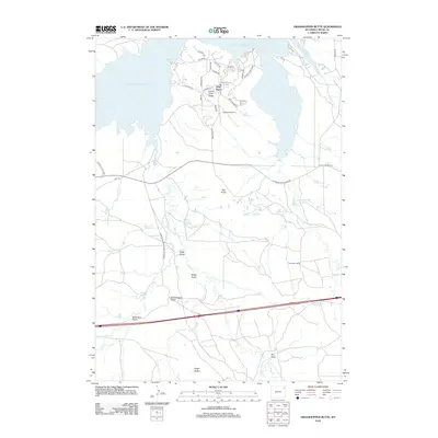
2012 Map of Grasshopper Butte
USGS Topo · Published 2012About this map
Pine Haven and the surrounding Crook County ranchlands are defined by the expansive waters of Keyhole Reservoir, which dominates the northern landscape of this quadrangle. This 2012 survey shows the residential development of Lower Pine Ridge and the local aviation hub at Keyhole Airport, set against the recreational backdrop of Keyhole State Park. The terrain south of the reservoir is marked by a series of significant drainage features and high points, including Grasshopper Butte and Pine Knob. Historical transportation routes such as Old Sundance Rd and the Sundance-Wind River Rd cut through the high plains, connecting isolated homesteads like Thompson Ranch to the regional network. The network of seasonal watercourses, from Wind Cr to Robinson Draw, illustrates the intricate drainage patterns that have shaped land use and ranching boundaries in this part of Wyoming.
Find a feature on this map
42 named features on this map. Tap any name to fly to it.
Don’t see what you’re looking for? This feature index may not catch every label — zoom into the map to look around manually.
Map Details
Editions of this 2012 Grasshopper Butte Map
This is the sole edition of this map. No revisions or reprints were ever made.
Other maps of this area

1918 · Moorcroft
USGS Topo · 1:125,000

1918 · Moorcroft
USGS Topo · 1:62,500

1954 · Sunny Divide
USGS Topo · 1:24,000

1954 · Carlile
USGS Topo · 1:24,000

1954 · Gillette
USGS Topo · 1:250,000

1955 · Gillette
USGS Topo · 1:250,000

1957 · Nefsy Divide
USGS Topo · 1:62,500

1957 · Moorcroft
USGS Topo · 1:62,500

1957 · Upton
USGS Topo · 1:62,500

1958 · Gillette
USGS Topo · 1:250,000