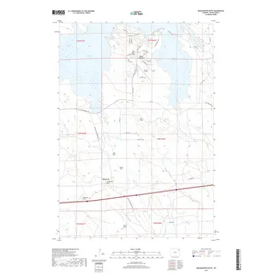
2017 Map of Grasshopper Butte
USGS Topo · Published 2017About this map
Pine Haven sits prominently on the shores of Keyhole Reservoir, serving as a central residential and recreational hub in this Wyoming landscape. The 2017 survey details the development of neighborhoods like Lower Pine Ridge, connected by a network of local roads including Hays Blvd and Vista Grande DR. The nearby Keyhole Airport and Pine Haven Cem highlight the community's established infrastructure during this period. Away from the shoreline, the terrain is defined by its drainage patterns and prominent elevations. Significant topographic features such as Grasshopper Butte, Pine Knob, and Eagle Buttes rise above the surrounding draws, including Nefsy Draw and Robinson Draw. The historical transit of the area is represented by both the Wind River-Grasshopper Butte Rd and the Old Sundance Hwy, tracing the movement of people and commerce through Crook County.
Find a feature on this map
50 named features on this map. Tap any name to fly to it.
Don’t see what you’re looking for? This feature index may not catch every label — zoom into the map to look around manually.
Map Details
Editions of this 2017 Grasshopper Butte Map
This is the sole edition of this map. No revisions or reprints were ever made.
Other maps of this area

1918 · Moorcroft
USGS Topo · 1:125,000

1918 · Moorcroft
USGS Topo · 1:62,500

1954 · Sunny Divide
USGS Topo · 1:24,000

1954 · Carlile
USGS Topo · 1:24,000

1954 · Gillette
USGS Topo · 1:250,000

1955 · Gillette
USGS Topo · 1:250,000

1957 · Nefsy Divide
USGS Topo · 1:62,500

1957 · Moorcroft
USGS Topo · 1:62,500

1957 · Upton
USGS Topo · 1:62,500

1958 · Gillette
USGS Topo · 1:250,000