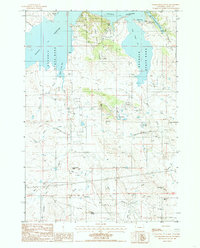
1984 Map of Grasshopper Butte
USGS Topo · Published 1985About this map
Keyhole State Park surrounds the northern reaches of Keyhole Reservoir in this mid-1980s landscape, where the high plains meet rugged drainage basins. The map illustrates a transitional environment shaped by both recreation and extractive industry, notably the numerous Bentonite Pits and Beatonite Pits scattered across the eastern terrain near Iron Run. The reservoir itself is defined by distinct inlets like Coulter Bay and Cottonwood Creek Bay, providing a stark contrast to the arid draws and buttes to the south.
Find a feature on this map
30 named features on this map. Tap any name to fly to it.
Don’t see what you’re looking for? This feature index may not catch every label — zoom into the map to look around manually.
Map Details
Editions of this 1984 Grasshopper Butte Map
This is the sole edition of this map. No revisions or reprints were ever made.
Other maps of this area

1918 · Moorcroft
USGS Topo · 1:125,000

1918 · Moorcroft
USGS Topo · 1:62,500

1954 · Sunny Divide
USGS Topo · 1:24,000

1954 · Carlile
USGS Topo · 1:24,000

1954 · Gillette
USGS Topo · 1:250,000

1955 · Gillette
USGS Topo · 1:250,000

1957 · Nefsy Divide
USGS Topo · 1:62,500

1957 · Moorcroft
USGS Topo · 1:62,500

1957 · Upton
USGS Topo · 1:62,500

1958 · Gillette
USGS Topo · 1:250,000