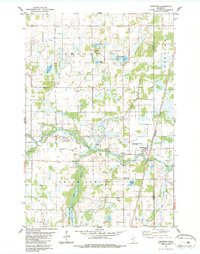
1983 Map of Grasston
USGS Topo · Published 1987About this map
Grasston stands near the confluence of local water systems and rail lines in this Kanabec County survey. The Snake River meanders across the central landscape, fed by tributaries like Mud Creek and Rice Creek. To the south, the Rice Creek State Wildlife Management Area preserves a significant portion of the wetland-rich terrain typical of east-central Minnesota. The transportation network is defined by the Burlington Northern railroad, which runs parallel to the county border. Genealogists and local historians will find several burial sites preserved on this sheet, including Grasston Union Cem near the river and Grass Lake Cem further south. The map also documents various municipal and agricultural features, from the Townhall in the north to numerous Gravel Pits and drainage infrastructure such as County Ditch No 1.
Find a feature on this map
27 named features on this map. Tap any name to fly to it.
Don’t see what you’re looking for? This feature index may not catch every label — zoom into the map to look around manually.
Map Details
Editions of this 1983 Grasston Map
2 editions found
Other maps of this area

1953 · Stillwater
USGS Topo · 1:250,000

1955 · Stillwater
USGS Topo · 1:250,000

1958 · Stillwater
USGS Topo · 1:250,000

1961 · Cambridge
USGS Topo · 1:62,500

1961 · Brook Park
USGS Topo · 1:62,500

1961 · Springvale
USGS Topo · 1:24,000

1961 · Dalbo
USGS Topo · 1:62,500

1965 · Stillwater
USGS Topo · 1:250,000

1968 · Mora North
USGS Topo · 1:24,000
1968 · Mora South
USGS Topo · 1:24,000