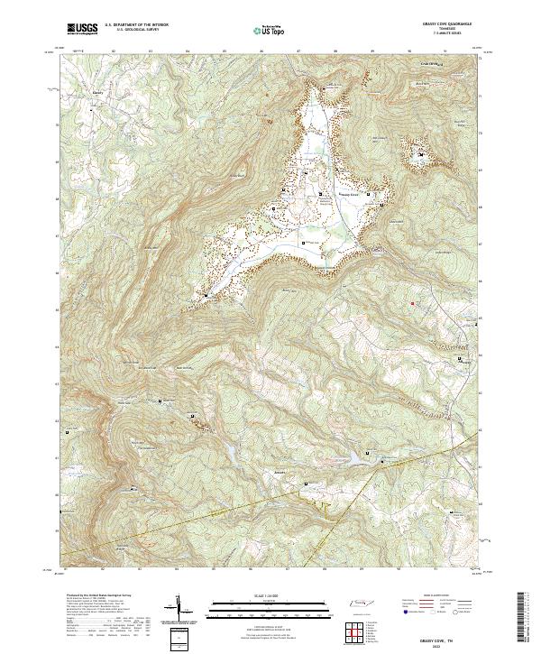
2022 Map of Grassy Cove
USGS Topo · Published 2022About this map
Grassy Cove dominates this Tennessee landscape, where the enclosed karst valley sits surrounded by high ridges like Brady Mtn and Black Mtn. This unusual geologic formation is a focal point for local history, centered on the Grassy Cove Methodist Church and a high concentration of family burial grounds, including the Derossett Cem, Davenport Cem, and Kemmer Cem. To the south and west, the terrain rises sharply toward Hinch Mtn and The Deadening, while water features like Daddys Creek and the Sequatchie River define the local drainage patterns.
Find a feature on this map
124 named features on this map. Tap any name to fly to it.
Don’t see what you’re looking for? This feature index may not catch every label — zoom into the map to look around manually.
Map Details
Editions of this 2022 Grassy Cove Map
This is the sole edition of this map. No revisions or reprints were ever made.
Other maps of this area

1887 · Kingston
USGS Topo · 1:125,000

1891 · Kingston
USGS Topo · 1:125,000

1892 · Pikeville
USGS Topo · 1:125,000

1893 · Kingston
USGS Topo · 1:125,000

1895 · Pikeville
USGS Topo · 1:125,000

1909 · Sequatchie Valley
USGS Topo · 1:62,500

1910 · Pikeville
USGS Topo · 1:62,500

1912 · Crossville
USGS Topo · 1:62,500

1935 · Melvine
USGS Topo · 1:24,000

1935 · Pennine
USGS Topo · 1:24,000