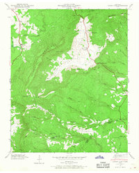
1946 Map of Grassy Cove
USGS Topo · Published 1968About this map
The remarkable limestone sinkhole of Grassy Cove dominates this Tennessee landscape, where the valley floor sits hundreds of feet below the surrounding peaks of Brady Mountain and Black Mountain. This geological karst feature is a self-contained basin where water drains into subterranean passages like Saltpeter Cave and Mill Cave rather than surface outlets. The 1946 field examination by the Tennessee Valley Authority records a network of rural life tied to these high-elevation valleys, including the small settlements of Alloway and Jewett.
Find a feature on this map
85 named features on this map. Tap any name to fly to it.
Don’t see what you’re looking for? This feature index may not catch every label — zoom into the map to look around manually.
Map Details
Editions of this 1946 Grassy Cove Map
This is the sole edition of this map. No revisions or reprints were ever made.
Other maps of this area

1887 · Kingston
USGS Topo · 1:125,000

1891 · Kingston
USGS Topo · 1:125,000

1892 · Pikeville
USGS Topo · 1:125,000

1893 · Kingston
USGS Topo · 1:125,000

1895 · Pikeville
USGS Topo · 1:125,000

1909 · Sequatchie Valley
USGS Topo · 1:62,500

1910 · Pikeville
USGS Topo · 1:62,500

1912 · Crossville
USGS Topo · 1:62,500

1935 · Melvine
USGS Topo · 1:24,000

1935 · Pennine
USGS Topo · 1:24,000