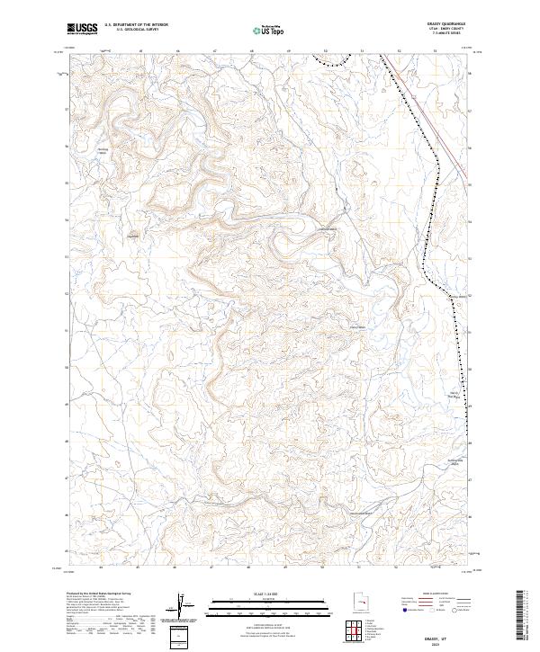
2023 Map of Grassy
USGS Topo · Published 2023About this map
The Price River winds through the northern reaches of this Emery County landscape, carving a deep path across a region defined by its complex drainage systems. Named washes like Humbug Wash and Coleman Wash branch out across the terrain, indicating a geography shaped by intermittent water flow and erosion. The prominence of Sugarloaf stands as a distinct topographic marker amidst the various drainages, including Camel Wash and Grassy Wash. This 2023 survey illustrates the modern configuration of the land, where the high desert environment is etched by ancient watercourses such as Middle Neversweat Wash and Neversweat Wash. The presence of 191, which skirts the eastern edge of the quadrangle, provides a modern artery through a largely uninhabited expanse of canyons and flats, connecting the remote watershed areas of Summerville Wash and Marsh Flat Wash.
Find a feature on this map
11 named features on this map. Tap any name to fly to it.
Don’t see what you’re looking for? This feature index may not catch every label — zoom into the map to look around manually.
Map Details
Editions of this 2023 Grassy Map
This is the sole edition of this map. No revisions or reprints were ever made.
Other maps of this area

1886 · Price River
USGS Topo · 1:250,000

1896 · Price River
USGS Topo · 1:250,000

1948 · Woodside
USGS Topo · 1:62,500

1949 · Woodside
USGS Topo · 1:62,500

1950 · Woodside
USGS Topo · 1:62,500

1956 · Price
USGS Topo · 1:250,000

1960 · Price
USGS Topo · 1:250,000

1962 · Price
USGS Topo · 1:250,000
1969 · Dry Mesa
USGS Topo · 1:24,000
1969 · Chimney Rock
USGS Topo · 1:24,000