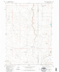
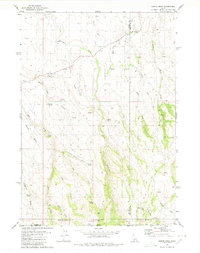
1980 Map of Grassy Hills
USGS Topo · Published 1980About this map
Devil Creek and its narrow drainage corridor carve through the high plains of the Owyhee and Twin Falls county line in this southern Idaho landscape. The region's dependence on water management is evident in the series of irrigation and livestock improvements, including Worley Reservoir, Little Grassy Reservoir, and the Worley Ditch. These man-made features support the local ranching economy, centered on sites like the House Creek Ranch and the aptly named The Windmill.
Find a feature on this map
22 named features on this map. Tap any name to fly to it.
Don’t see what you’re looking for? This feature index may not catch every label — zoom into the map to look around manually.
Map Details
Editions of this 1980 Grassy Hills Map
2 editions found
Other maps of this area

1955 · Twin Falls
USGS Topo · 1:250,000

1958 · Twin Falls
USGS Topo · 1:250,000

1964 · Roseworth
USGS Topo · 1:24,000

1977 · Cedar Creek Reservoir
USGS Topo · 1:24,000

1978 · Taylor Canyon
USGS Topo · 1:24,000

1979 · Salls Crossing
USGS Topo · 1:24,000
1979 · Roseworth
USGS Topo · 1:24,000
1979 · Three Creek
USGS Topo · 1:24,000

1979 · Coonskin Butte
USGS Topo · 1:24,000
1980 · Curtis Draw
USGS Topo · 1:24,000