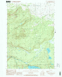
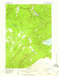
1989 Map of Grassy Lake Reservoir
USGS Topo · Published 1989About this map
Pitchstone Plateau dominates the northern terrain of this Teton County survey, where volcanic geology and high-altitude water systems define the landscape. This 1980s record captures a sensitive interface where Yellowstone National Park meets the Targhee National Forest, and the John D Rockefeller Jr Memorial Parkway. The hydrological network is centered on the Grassy Lake Reservoir and the Falls River, which is fed by numerous tributaries including Ash Creek and Proposition Creek. Remote settlements such as Terraced Falls and Cascade Acres are documented alongside specialized infrastructure like a Gaging Sta and a Gravel Pit. Backcountry access is traced through established paths like the Pitchstone Plateau Trail and the Beula Lake Trail, providing a clear view of the region's managed wilderness and recreational corridors before the turn of the millennium.
Find a feature on this map
26 named features on this map. Tap any name to fly to it.
Don’t see what you’re looking for? This feature index may not catch every label — zoom into the map to look around manually.
Map Details
Editions of this 1989 Grassy Lake Reservoir Map
2 editions found
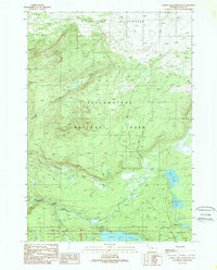
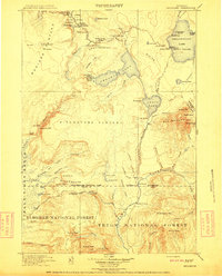
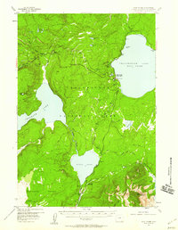
Other maps of this area

1886 · Shoshone
USGS Topo · 1:125,000

1888 · Shoshone
USGS Topo · 1:125,000

1895 · Shoshone
USGS Topo · 1:125,000

1901 · Shoshone
USGS Topo · 1:125,000

1908 · Shoshone
USGS Topo · 1:125,000
1911 · Shoshone
USGS Topo · 1:125,000

1955 · Ashton
USGS Topo · 1:250,000
1956 · West Thumb
USGS Topo · 1:62,500
1956 · Old Faithful
USGS Topo · 1:62,500
1956 · Grassy Lake Reservoir
USGS Topo · 1:62,500