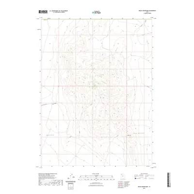
2023 Map of Grassy Mountains
USGS Topo · Published 2023About this map
Grassy Mountains dominate this high-desert terrain within Tooele County, where elevations rise sharply from the basin floor. The landscape is defined by stark topographic relief, characterized by the elongated Finger Ridge and the prominent height of Cobble Hill. A single road, Finger Ridge Peak Rd, provides the primary access point into these heights from the west, skirting the edge of Ripple Valley. The mapping demonstrates a contemporary look at federal and state lands in the Great Salt Lake Desert region, capturing the complex network of ridges and drainages that shape this arid environment. Collectors and land researchers will find the precise contour work valuable for understanding the drainage patterns and inaccessible peaks of this Great Basin range.
Find a feature on this map
6 named features on this map. Tap any name to fly to it.
Don’t see what you’re looking for? This feature index may not catch every label — zoom into the map to look around manually.
Map Details
Editions of this 2023 Grassy Mountains Map
This is the sole edition of this map. No revisions or reprints were ever made.
Other maps of this area

1885 · Tooele Valley
USGS Topo · 1:250,000

1953 · Tooele
USGS Topo · 1:250,000

1954 · Brigham City
USGS Topo · 1:250,000

1955 · Tooele
USGS Topo · 1:250,000

1958 · Brigham City
USGS Topo · 1:250,000

1962 · Brigham City
USGS Topo · 1:250,000

1973 · Ripple Valley
USGS Topo · 1:24,000

1973 · Grassy Mountains
USGS Topo · 1:24,000

1973 · Low
USGS Topo · 1:24,000

1973 · Grayback Hills
USGS Topo · 1:24,000