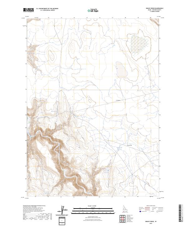
2023 Map of Grassy Ridge
USGS Topo · Published 2023About this map
The South Fork Owyhee Wild and Scenic River carves a deep canyon through this high-desert landscape in southwestern Idaho. This protected corridor is part of the extensive Owyhee River Wilderness, an area characterized by dramatic elevation shifts and volcanic plateaus. The topography is dominated by Grassy Ridge, which separates the river valley from the expansive Y P Desert to the east. Sparse water resources are captured in several small catchments, including Shea Reservoir, Coyote Flat Reservoir, and Coyote Hole Reservoir. The map illustrates the specialized hydrology required for life in Coyote Flat, where human-made reservoirs contrast with the natural drainage of the deep river basin. This recent survey from the U.S. Geological Survey documents the current state of these wilderness boundaries and the seasonal water sources critical to this arid environment.
Find a feature on this map
15 named features on this map. Tap any name to fly to it.
Don’t see what you’re looking for? This feature index may not catch every label — zoom into the map to look around manually.
Map Details
Editions of this 2023 Grassy Ridge Map
This is the sole edition of this map. No revisions or reprints were ever made.
Other maps of this area

1955 · Jordan Valley
USGS Topo · 1:250,000

1957 · Jordan Valley
USGS Topo · 1:250,000

1958 · Jordan Valley
USGS Topo · 1:250,000

1973 · Coyote Hole
USGS Topo · 1:24,000

1973 · Red Basin
USGS Topo · 1:24,000
1973 · Piute Basin West
USGS Topo · 1:24,000

1973 · Grassy Ridge
USGS Topo · 1:24,000

1973 · Spring Creek Basin
USGS Topo · 1:24,000

1973 · Bull Camp Butte
USGS Topo · 1:24,000
1973 · Star Valley
USGS Topo · 1:24,000