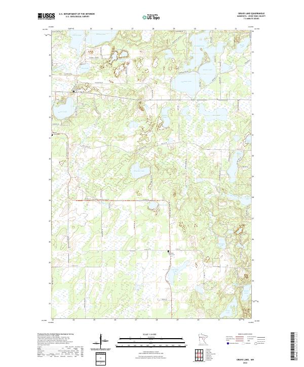
2022 Map of Grave Lake
USGS Topo · Published 2022About this map
Oak Grove Cem and Maple Grove Cem anchor the northwestern corner of this Crow Wing County landscape, marking the enduring presence of local families amidst a dense network of glacial lakes and wetlands. The hydrography is the dominant character of the region, from the wide expanse of Grave Lake to the north-flowing Nokasippi River. Long-standing transportation patterns are visible in the winding path of Mail Route Rd and the Crow Wing Southern Loop Trl, which meanders through the central lowlands past Chrysler Lake and Wilson Lake. To the southeast, the terrain becomes increasingly complex around Borden Lake and Williams Lake, where local roads like Robinwood Ln and Miller Lake Rd provide access to the water. The placement of Dykeman Union Cem near Jack Pine Lake provides a specific point of interest for those tracing rural settlement history in this part of Minnesota.
Find a feature on this map
82 named features on this map. Tap any name to fly to it.
Don’t see what you’re looking for? This feature index may not catch every label — zoom into the map to look around manually.
Map Details
Editions of this 2022 Grave Lake Map
This is the sole edition of this map. No revisions or reprints were ever made.
Other maps of this area

1912 · Deerwood
USGS Topo · 1:62,500

1914 · Deerwood
USGS Topo · 1:62,500

1915 · Brainerd
USGS Topo · 1:62,500

1918 · Brainerd
USGS Topo · 1:62,500

1948 · Lastrup
USGS Topo · 1:62,500

1950 · Lastrup
USGS Topo · 1:62,500

1953 · Duluth
USGS Topo · 1:250,000

1953 · Brainerd
USGS Topo · 1:250,000

1957 · Brainerd
USGS Topo · 1:250,000

1958 · Brainerd
USGS Topo · 1:250,000