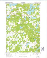
1973 Map of Grave Lake
USGS Topo · Published 1976About this map
Nokay Lake and the Nokasippi River anchor this mid-1970s view of the lake-strewn country of Crow Wing County. The landscape is a dense network of water bodies, including Grave Lake, Portage Lake, and Borden Lake, which are interspersed with the organized townships of Maple Grove, Bay Lake, Garrison, and Nokay Lake. Small-scale industry is present through the scattered Gravel Pit and Sandpit locations, while the civic life of these communities is preserved through labels for the Townhall and several historical burial grounds. Genealogists will find particular value in the precise locations of the Oak Grove Cem, Maple Grove Cem, and Dykeman Union Cem. The inclusion of a Radio Tower and Public Access points for fishing and boating reflects the area's mid-century balance of remote recreation and developing infrastructure.
Find a feature on this map
35 named features on this map. Tap any name to fly to it.
Don’t see what you’re looking for? This feature index may not catch every label — zoom into the map to look around manually.
Map Details
Editions of this 1973 Grave Lake Map
This is the sole edition of this map. No revisions or reprints were ever made.
Other maps of this area

1912 · Deerwood
USGS Topo · 1:62,500

1914 · Deerwood
USGS Topo · 1:62,500

1915 · Brainerd
USGS Topo · 1:62,500

1918 · Brainerd
USGS Topo · 1:62,500

1948 · Lastrup
USGS Topo · 1:62,500

1950 · Lastrup
USGS Topo · 1:62,500

1953 · Duluth
USGS Topo · 1:250,000

1953 · Brainerd
USGS Topo · 1:250,000

1957 · Brainerd
USGS Topo · 1:250,000

1958 · Brainerd
USGS Topo · 1:250,000